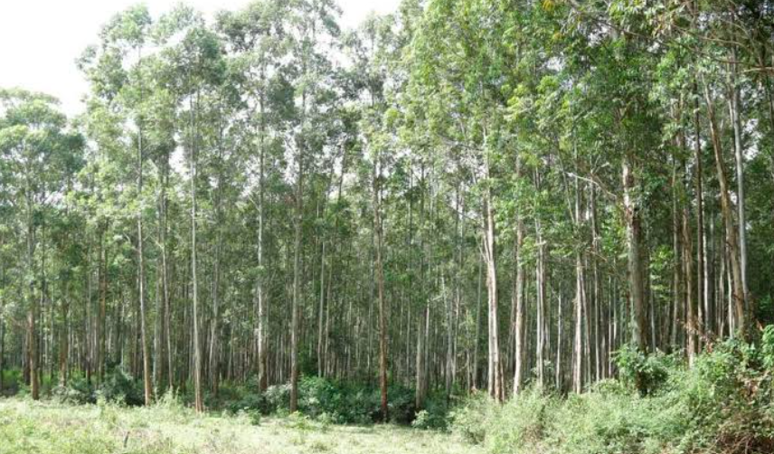
Canada is one of the world’s great forest countries. From the coastal rainforests of British Columbia and the vast boreal forests of Ontario and Quebec to the mixed Acadian forests of New Brunswick and Nova Scotia, forests cover an enormous portion of the country.
Canada has about 368.7 million hectares of forest, equivalent to roughly 40% of its land area. That represents approximately 9% of the world’s forests. Most of Canada’s forest is concentrated across the enormous boreal region, which stretches from Newfoundland and Labrador across the country to Yukon and the Northwest Territories.
But forest cover is not distributed evenly. Some provinces and territories are overwhelmingly forested, while Nunavut has very little forest because most of its land lies north of the natural tree line. The differences are shaped by latitude, climate, elevation, soil, precipitation, wildfire, glaciation, and the distribution of Canada’s major forest ecosystems.
Forest Cover by Province and Territory at a Glance
The table below uses a recent national forest-inventory research dataset to compare forest area among jurisdictions. Because forest definitions and inventory boundaries can differ between datasets, the percentages should be treated as comparative estimates rather than a replacement for the official National Forest Inventory statistics. The dataset reports about 403.1 million hectares of forest across the jurisdictions it covers.
| Province or territory | Approx. forest area | Approx. share of jurisdiction in dataset |
|---|---|---|
| British Columbia | 65.11 million ha | 68.8% |
| Quebec | 81.78 million ha | 54.3% |
| Ontario | 65.97 million ha | 61.2% |
| Alberta | 35.61 million ha | 53.6% |
| Saskatchewan | 26.34 million ha | 40.5% |
| Manitoba | 27.45 million ha | 42.1% |
| Newfoundland and Labrador | 19.93 million ha | 49.4% |
| Northwest Territories | 45.52 million ha | 33.8% |
| Yukon | 23.32 million ha | 48.1% |
| New Brunswick | 6.41 million ha | 88.2% |
| Nova Scotia | 4.56 million ha | 82.8% |
| Prince Edward Island | 0.27 million ha | 47.4% |
| Nunavut | 0.85 million ha | 0.4% |
The research dataset estimates approximately 403.14 million hectares of forest across the jurisdictions, but its methodology differs from the Canadian National Forest Inventory. For national comparisons, Natural Resources Canada reports approximately 368.7 million hectares of forest for 2024.
1. British Columbia
British Columbia contains one of Canada’s largest and most diverse forest landscapes. The province has approximately 65.1 million hectares of forest in the comparative inventory dataset, making it one of Canada’s most heavily forested jurisdictions.
Its forests range from the giant conifers of the Pacific coast to interior Douglas-fir, lodgepole pine, spruce, subalpine forests, and boreal forest in the northeast. British Columbia’s forests are also economically important, supporting one of Canada’s largest forest sectors.
The province’s forests have experienced major disturbances from wildfire, insects, drought, and other factors. The mountain pine beetle epidemic, for example, significantly affected British Columbia’s forest landscape and timber supply.
2. Quebec
Quebec has approximately 81.8 million hectares of forest in the comparative dataset, giving it the largest forest area of any province in that dataset.
The province stretches across several major ecological regions. Southern Quebec contains mixed forests dominated by species such as sugar maple, yellow birch, and balsam fir, while farther north the landscape becomes increasingly boreal, with black spruce, white spruce, jack pine, and tamarack.
Quebec’s enormous geographic area means its forests vary greatly from the relatively productive southern hardwood forests to the slower-growing forests of the far north.
3. Ontario
Ontario contains approximately 66.0 million hectares of forest, making it another major contributor to Canada’s total forest area.
Ontario’s forests span several broad ecological zones. Southern Ontario contains the province’s remaining deciduous and mixed forests, while central and northern Ontario are dominated by boreal and mixedwood forests.
Important species include black spruce, jack pine, balsam fir, trembling aspen, white pine, red pine, sugar maple, yellow birch, and white spruce.
Ontario’s forests are also important for wildlife habitat, carbon storage, recreation, Indigenous cultural practices, and the forest-products industry.
4. Alberta
Alberta has approximately 35.6 million hectares of forest in the comparative inventory dataset.
The province’s forests are concentrated primarily in the northern and western parts of Alberta. The boreal forest covers much of northern Alberta, while foothill and montane forests occur toward the Rocky Mountains.
White spruce, black spruce, lodgepole pine, jack pine, trembling aspen, balsam poplar, and tamarack are among the important trees found across Alberta’s forest regions.
Alberta also has extensive areas of prairie and agricultural land, which explains why its forest cover is considerably lower proportionally than heavily forested Atlantic provinces.
5. Saskatchewan
Saskatchewan contains approximately 26.3 million hectares of forest in the comparative dataset.
The province is often associated with its agricultural landscape, but its northern half contains extensive boreal forest. The transition from prairie to aspen parkland and then to boreal forest creates a dramatic north-south change in vegetation.
Northern Saskatchewan contains forests dominated by black spruce, white spruce, jack pine, trembling aspen, balsam poplar, and tamarack.
Wildfire is a major natural force in these forests, periodically resetting large areas and creating conditions for young forest regeneration.
6. Manitoba
Manitoba has approximately 27.5 million hectares of forest in the comparative dataset.
The province’s forest region begins north of the agricultural belt and expands into a vast boreal landscape. Black spruce, jack pine, trembling aspen, balsam fir, white spruce, and tamarack are among its characteristic trees.
Manitoba’s northern forests are part of the larger Canadian boreal system that stretches continuously across much of the country.
The province therefore contributes significantly to Canada’s overall forest area despite having extensive agricultural land in the south.
7. Newfoundland and Labrador
Newfoundland and Labrador has approximately 19.9 million hectares of forest in the comparative dataset.
Most of the province’s forest occurs in Newfoundland and the southern and central portions of Labrador. Black spruce, balsam fir, white birch, and trembling aspen are important components of the landscape.
Labrador in particular contains vast areas of relatively remote boreal forest. The province’s cool climate, extensive wetlands, rocky terrain, and frequent natural disturbances create forest communities that differ from those farther west.
8. New Brunswick
New Brunswick is one of Canada’s most heavily forested provinces proportionally. The comparative dataset estimates approximately 6.4 million hectares of forest, representing about 88% of the province’s area within that dataset.
The province forms part of the Acadian Forest region, where red spruce, balsam fir, sugar maple, yellow birch, red maple, eastern white pine, and other species occur.
Forests dominate much of the landscape outside agricultural and developed areas, which helps explain why forestry has historically been such an important part of New Brunswick’s economy.
9. Nova Scotia
Nova Scotia has approximately 4.6 million hectares of forest in the comparative dataset, equivalent to roughly 83% of its jurisdictional area in that dataset.
The province is another major part of the Acadian Forest region. Red spruce, balsam fir, red maple, sugar maple, yellow birch, white pine, eastern hemlock, and black spruce are among the trees associated with Nova Scotia’s forests.
Despite its relatively small land area, Nova Scotia has a very high proportion of forest cover. Forests occur across much of the province, from coastal landscapes to inland hills and wetlands.
10. Prince Edward Island
Prince Edward Island has a much smaller forest area than most Canadian provinces, with approximately 270,000 hectares in the comparative dataset.
Agriculture occupies a substantial portion of the island, meaning that the remaining forests tend to occur in smaller and more fragmented patches.
Red maple, white spruce, balsam fir, white pine, sugar maple, yellow birch, and various hardwood species can be found across the island. Forest conservation and expansion have therefore become important issues for maintaining wildlife habitat and ecological connectivity.
11. Yukon
Yukon contains approximately 23.3 million hectares of forest in the comparative dataset.
Much of Yukon’s forest is found in the southern and central parts of the territory. White spruce, black spruce, lodgepole pine, trembling aspen, and balsam poplar are important species.
Yukon’s high latitude and mountainous terrain strongly influence forest growth. Trees generally grow more slowly than they would in southern Canada, and the northern tree line marks the transition between forest and tundra.
12. Northwest Territories
The Northwest Territories contain approximately 45.5 million hectares of forest in the comparative dataset.
Although the territory is enormous, much of its northern landscape lies beyond the natural tree line. Forests are concentrated primarily in the southern and central portions of the territory.
Black spruce, white spruce, jack pine, tamarack, trembling aspen, and balsam poplar are important northern tree species. Forest growth is generally slow because of the short growing season, cold climate, permafrost in many locations, and limited soil development.
13. Nunavut
Nunavut is dramatically different from Canada’s other jurisdictions. The comparative dataset records only about 0.85 million hectares of forest, representing less than 1% of its enormous land area.
The reason is geography. Most of Nunavut lies north of Canada’s natural tree line, where temperatures and growing seasons are insufficient to support extensive forests.
Small patches of trees and shrubs occur in the southernmost parts of the territory, particularly in sheltered locations, but Nunavut is primarily a tundra landscape rather than a forested one.
Which Province Has the Most Forest?
In terms of total forest area, Quebec is among the largest, with approximately 81.8 million hectares in the comparative forest-area dataset. Ontario and British Columbia follow closely at approximately 66.0 and 65.1 million hectares respectively.
The exact ranking can change depending on the definition of forest, inventory methodology, and reference year. This is important because Canada’s national forest statistics are continually updated as inventories improve.
Natural Resources Canada’s current national reporting estimates 368.7 million hectares of forest in 2024, compared with the larger figure in the research dataset used for the jurisdictional comparison above.
Which Province Has the Highest Percentage of Forest?
Among the provinces, New Brunswick and Nova Scotia stand out for their exceptionally high proportion of forested land. The comparative dataset estimates approximately 88% for New Brunswick and 83% for Nova Scotia.
British Columbia also has a very high proportion of forest, although its enormous mountains, alpine areas, grasslands, dry interior landscapes, and other non-forest ecosystems reduce the percentage compared with some Atlantic provinces.
Nunavut is at the opposite extreme, with almost no forest because most of the territory is beyond the tree line.
Why Is Canada So Heavily Forested?
Canada’s enormous forest area is primarily a result of its geography and climate.
The country extends across a huge portion of the Northern Hemisphere, including an enormous belt of boreal ecosystems. More than three-quarters of Canada’s forest area is associated with the boreal zone.
Several factors help explain Canada’s forest distribution:
The Boreal Forest
Canada’s boreal forest stretches across much of the country from Newfoundland and Labrador to Yukon. It contains enormous areas of spruce, pine, fir, birch, poplar, and other northern trees.
Low Population Density
Large portions of Canada have very few people and relatively little permanent development. Vast forest landscapes therefore remain intact or semi-natural.
Climate
The cool northern climate limits agriculture across much of the country but supports extensive forests adapted to short growing seasons.
Natural Disturbances
Wildfire, insects, windstorms, and other disturbances are natural components of Canadian forest ecosystems. Canada’s forest area can remain relatively stable even while the location and condition of tree cover change substantially.
Canada’s Forests Are Not All the Same
One of the biggest misconceptions about Canadian forests is that they form one enormous uniform forest.
They do not.
Canada contains coastal rainforests, temperate hardwood forests, Acadian forests, Great Lakes–St. Lawrence forests, boreal mixedwoods, mountain forests, subalpine forests, and northern forests approaching the tree line.
For example, the forests of coastal British Columbia can contain enormous western redcedar, Douglas-fir, western hemlock, and Sitka spruce, while northern Saskatchewan and Manitoba are dominated by boreal species such as black spruce, jack pine, and trembling aspen.
The Atlantic provinces have a very different ecological character again, with strong representation of red spruce, balsam fir, sugar maple, yellow birch, red maple, and white pine.
Forest Area vs. Tree Cover: What’s the Difference?
The terms forest area, forest cover, and wooded land are sometimes used interchangeably in everyday conversation, but they are not necessarily identical in statistical reporting.
Canada’s National Forest Inventory uses a standardized definition so that forest area can be monitored consistently over time and compared internationally. Natural Resources Canada notes that forest area itself is relatively stable, while actual tree cover can change because of wildfire, insects, harvesting, and subsequent regeneration.
This distinction matters when comparing provinces.
A forest that has recently burned may still be classified as forest land if it is expected to return to forest, even though it temporarily has little or no visible tree cover.
Canada’s Forests and Wildfire
Wildfire is a natural and increasingly important force shaping Canada’s forests.
The 2023 wildfire season was extraordinary. Canada recorded approximately 17.2 million hectares of area burned, by far the largest annual total in the national record presented by Natural Resources Canada.
The effects were particularly significant in Quebec, British Columbia, Alberta, and the Northwest Territories, all of which experienced exceptionally large burned areas during the 2023 season. Research on the event estimated that roughly 4% of Canada’s forest area was affected by fire that year.
A burned forest is not necessarily a permanently lost forest. Many Canadian tree species are adapted to fire, and forests can regenerate naturally over time. However, repeated severe fires, drought, insects, and other disturbances can alter forest composition and structure.
How Much of Canada’s Forest Is Publicly Owned?
Canada’s forests are overwhelmingly publicly owned.
Natural Resources Canada reports that approximately 90% of Canada’s forests are owned by provincial and territorial governments, with another portion owned by the federal government and other public bodies. Only a relatively small share is privately owned.
This is important because forest management responsibilities are largely decentralized. Provinces and territories establish forestry regulations, determine allowable harvest levels, administer forest tenures, and manage much of the public forest estate.
Why Forest Cover Matters
Canada’s forests provide far more than timber.
They provide habitat for wildlife, store carbon, protect watersheds, moderate local climates, support recreation, and contribute to Indigenous cultural practices. They also support thousands of communities and businesses through forestry, tourism, manufacturing, and related industries.
Canada’s forests are also a major part of the country’s carbon cycle. Their ability to absorb and store carbon depends on forest age, productivity, disturbance, climate, soil conditions, and management.
Which Canadian Regions Are the Most Forested?
If the goal is to identify areas where forests dominate the landscape, the strongest examples are:
- New Brunswick — exceptionally high forest proportion
- Nova Scotia — extensive forest cover across a relatively small province
- British Columbia — enormous forest area and extensive mountain/coastal forests
- Quebec — vast boreal and mixed forest landscapes
- Ontario — huge northern forest region
- Newfoundland and Labrador — extensive boreal forest
- Yukon — large northern forest region, especially in the south
- Alberta — extensive boreal and foothill forests
- Manitoba and Saskatchewan — extensive northern boreal forests
The territories require more nuance because their enormous total areas include extensive tundra and other non-forest ecosystems.
Final Thoughts
Canada’s forest cover is one of the country’s defining geographical features. With roughly 368.7 million hectares of forest, Canada contains an extraordinary variety of forest ecosystems, from coastal temperate forests to the vast boreal belt and the northern edge of the tree line.
The distribution is highly uneven. Quebec, Ontario, and British Columbia contain some of the largest total forest areas, while New Brunswick and Nova Scotia stand out for the exceptionally high proportion of their land covered by forest. At the other end of the scale, Nunavut has almost no forest because most of its territory lies above the natural tree line.
Ultimately, forest cover is more than a statistic. Canada’s forests are living ecosystems shaped by climate, fire, insects, human activity, and natural regeneration. Understanding how forest cover varies from province to province helps explain Canada’s landscapes, forestry industry, biodiversity, and the enormous ecological importance of its forests.