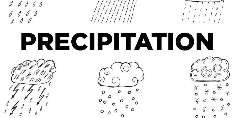
Precipitation refers to any form of water — whether liquid or solid — that falls from clouds in the atmosphere to the Earth’s surface, representing a fundamental component of the water cycle that distributes fresh water across the planet. Without precipitation, the continuous movement of water from oceans to the atmosphere to the land and back again would break down entirely, making this process essential to virtually all life on Earth. The form that precipitation takes depends primarily on the temperature conditions it encounters as it falls through the atmosphere, from the cloud where it forms down to the ground.
Precipitation begins inside clouds, where tiny water droplets or ice crystals grow large enough to overcome the air currents that keep them suspended and begin to fall toward the ground. This growth process occurs through the collision and combination of smaller droplets or crystals, or through a process in which ice crystals grow at the expense of surrounding water droplets in clouds containing both. The specific conditions present within the cloud — particularly temperature — determine whether the resulting precipitation will form primarily as liquid water droplets or as ice crystals.
As precipitation falls from the cloud toward the surface, it passes through layers of the atmosphere that may have very different temperatures, and these temperature profiles can dramatically alter the form that precipitation takes by the time it reaches the ground. A snowflake that forms in a cold cloud might melt completely into rain if it passes through a thick layer of warm air below, while a raindrop might refreeze into ice if it passes through a layer of freezing air near the surface. This interaction between the precipitation type formed in the cloud and the temperature profile of the atmosphere below creates the remarkable diversity of precipitation types observed at the surface.
Understanding the different types of precipitation is essential for weather forecasting, agriculture, transportation safety, and countless other practical applications, as the specific form precipitation takes has dramatically different effects on daily life — a light rain shower has very different implications than an ice storm or a blizzard, even though both ultimately represent water falling from the sky. The following overview explores the major types of precipitation and the atmospheric conditions that produce each one.
Rain
Rain is liquid precipitation that falls when water droplets within a cloud grow large enough to fall to the ground while remaining in liquid form throughout their descent. It is by far the most common and widespread type of precipitation experienced across most of the world.
Rain forms when cloud droplets collide and merge with one another, gradually growing from microscopic sizes to droplets large enough to fall against the upward currents within the cloud. The intensity of rain can range from a light drizzle, with very small droplets falling slowly, to heavy downpours during intense thunderstorms, where large droplets fall rapidly and in great quantity.
Drizzle
Drizzle is a form of liquid precipitation consisting of very small water droplets, generally less than half a millimeter in diameter, that fall slowly and steadily from low clouds, often stratus clouds. Its small droplet size distinguishes drizzle from ordinary rain.
Because drizzle droplets are so small and light, they often appear to float in the air rather than fall directly downward, and they can create a misty, hazy appearance that reduces visibility even though the actual amount of water reaching the ground may be quite small. Drizzle frequently occurs in association with fog, as both phenomena often form under similar atmospheric conditions involving low-level moisture and gentle cooling.
Snow
Snow is solid precipitation consisting of ice crystals that form within clouds where temperatures are below freezing throughout the cloud and the atmosphere beneath it, allowing the crystals to reach the ground without melting. Each snowflake forms through a unique process of ice crystal growth.
The growth of snowflakes occurs through a process in which water vapor deposits directly onto ice crystals, causing them to grow larger while developing the intricate, branching patterns that make snowflakes so visually distinctive. The specific shape and structure of snowflakes depends on the temperature and humidity conditions present during their formation, which is why no two snowflakes are exactly alike.
Sleet
Sleet refers to small, translucent pellets of ice that form when snowflakes partially melt as they fall through a layer of warm air, then refreeze into ice pellets as they pass through a subsequent layer of below-freezing air closer to the ground. This refreezing process distinguishes sleet from snow.
Unlike freezing rain, which remains liquid until it strikes a surface, sleet has already frozen into solid ice pellets before reaching the ground, often producing a distinctive tapping sound as it strikes windows, roofs, and other surfaces. Sleet typically occurs during winter storms where a layer of warm air aloft is sandwiched between colder air at the cloud level and colder air near the surface.
Freezing Rain
Freezing rain consists of liquid raindrops that remain in liquid form as they fall through the atmosphere but freeze immediately upon contact with surfaces that are at or below freezing temperature, creating a coating of clear ice on roads, trees, power lines, and other objects. This delayed freezing is what distinguishes freezing rain from sleet.
The ice that accumulates from freezing rain can become extremely heavy, particularly on trees and power lines, sometimes causing branches to break and power outages to occur across wide areas during significant ice storm events. Freezing rain creates some of the most hazardous travel conditions of any precipitation type, as the resulting ice coating on roads can be nearly invisible while creating extremely slippery surfaces.
Hail
Hail consists of balls or irregular lumps of ice that form within strong thunderstorms, growing through repeated cycles of being carried upward by powerful updrafts into colder portions of the cloud, where additional layers of ice accumulate, before eventually becoming heavy enough to fall to the ground. This layered growth process can be seen if a hailstone is cut in half.
The size of hailstones can vary enormously, from small pellets barely larger than a pea to massive stones several centimeters in diameter capable of causing significant damage to vehicles, roofs, and crops. The formation of large hail requires particularly strong updrafts within a thunderstorm, capable of repeatedly lifting growing ice particles back into the coldest parts of the cloud before they become too heavy to be supported.
Graupel
Graupel, sometimes called snow pellets, consists of small, soft, white ice particles that form when snowflakes become coated with a layer of rime ice as they fall through a cloud containing supercooled water droplets. This coating process gives graupel a distinctive crumbly, opaque appearance quite different from typical snowflakes.
Unlike hail, which forms through the repeated cycling typical of strong thunderstorm updrafts, graupel forms through a simpler process of supercooled droplets freezing onto a falling snowflake as it passes through a cloud just once. Graupel particles are generally softer and more fragile than hailstones, often crumbling or breaking apart easily when they land or are touched.
Ice Pellets
Ice pellets is a term sometimes used interchangeably with sleet to describe small, hard ice particles that reach the ground in frozen form, though in some classification systems the term refers more specifically to the transparent or translucent pellets that result from the refreezing of melted snowflakes. The terminology can vary between different meteorological traditions.
These pellets typically bounce slightly when they strike a hard surface, distinguishing them both from the softer graupel and from freezing rain, which remains liquid until impact. The presence of ice pellets during a winter storm often indicates a complex vertical temperature structure in the atmosphere, with at least one layer of warm air aloft sufficient to partially melt falling snow before refreezing occurs.
Virga
Virga refers to precipitation that falls from a cloud but evaporates completely before reaching the ground, creating a visible streak or wisp of precipitation hanging beneath the cloud that never actually makes contact with the surface. This phenomenon is particularly common in arid regions.
The appearance of virga depends on a significant difference in humidity between the cloud where precipitation forms and the drier air beneath it, with the falling precipitation evaporating as it encounters this drier air and absorbs heat from its surroundings in the process. Virga can sometimes contribute to the development of strong downdrafts, as the evaporative cooling associated with this process can create pockets of dense, rapidly descending air.
Snow Grains
Snow grains are very small, opaque grains of ice, generally smaller than typical snowflakes and lacking the branching crystal structure that gives ordinary snow its distinctive appearance. They typically fall in small quantities and accumulate slowly.
This form of precipitation is associated with stratus clouds and tends to occur under relatively stable atmospheric conditions, unlike the more dynamic processes that produce larger snowflakes or graupel. Snow grains are sometimes described as the solid equivalent of drizzle, given their small size and the gentle, steady manner in which they typically fall.
Diamond Dust
Diamond dust, also known as ice fog in some contexts, consists of tiny ice crystals that form directly in the air near the ground under extremely cold and typically clear conditions, rather than falling from a cloud overhead. These tiny crystals can create a sparkling effect when illuminated by sunlight.
This phenomenon typically occurs in polar regions and other extremely cold environments where temperatures are low enough for water vapor in the air to transform directly into ice crystals without first condensing into liquid droplets. The slow settling of these tiny crystals can sometimes create optical effects such as sun pillars or halos around light sources, adding to the visually striking nature of this rare precipitation type.