Rivers are the arteries of the Earth — dynamic, ever-moving systems of flowing water that drain the land, carve the landscape, transport sediment, sustain ecosystems, and support human civilization on a scale that no other freshwater feature can match. From the mightiest continental rivers carrying billions of cubic meters of water to the sea each year, to the smallest seasonal streams trickling across arid plains for only a few weeks annually, rivers represent the primary mechanism by which water moves from the land back to the ocean, completing the great hydrological cycle that makes life on Earth possible.
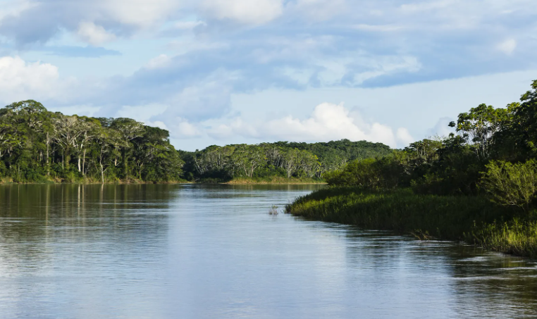
The global river system is staggering in its extent and complexity. The world’s rivers collectively discharge approximately 37,000 cubic kilometers of freshwater into the oceans every year — a figure that represents the total runoff from all the world’s land surfaces. The Amazon River alone carries approximately 20 percent of all the freshwater discharged by the world’s rivers into the oceans, with an average discharge of about 209,000 cubic meters per second at its mouth. The Nile, stretching 6,650 kilometers from its headwaters in the East African highlands to its delta on the Mediterranean coast, held the record as the world’s longest river for most of recorded history. The world’s rivers have carved valleys covering an estimated 12 percent of the Earth’s land surface and support an extraordinary proportion of global biodiversity — freshwater ecosystems, despite covering less than 1 percent of the Earth’s surface, harbor approximately 10 percent of all known species.
Rivers have been the cradles of human civilization since the earliest agricultural settlements arose along their banks thousands of years ago. The Nile, the Tigris, the Euphrates, the Indus, and the Yellow River all nurtured the world’s first urban civilizations, providing water for irrigation, highways for trade and communication, and fertile floodplain soils enriched by annual floods. Today, rivers remain central to human life — providing drinking water for billions of people, generating approximately 16 percent of the world’s electricity through hydropower, supporting inland navigation networks that carry hundreds of millions of tons of freight annually, and sustaining fisheries that feed hundreds of millions of people worldwide. Understanding the different types of rivers illuminates the extraordinary variety of ways in which flowing water interacts with the landscape, climate, and human societies it encounters.
Perennial Rivers
Perennial rivers flow continuously throughout the year, maintaining a permanent channel with running water in all seasons regardless of short-term fluctuations in rainfall. They are sustained by a combination of surface runoff, groundwater contributions from aquifers that feed baseflow into the channel during dry periods, and in many cases by snowmelt or glacial melt from their headwater regions. Perennial rivers are the most important rivers for human settlement and civilization, providing reliable water supplies that support agriculture, industry, and urban life year-round. The Amazon, the Congo, the Mississippi, and the Ganges are all perennial rivers. The Congo River is the world’s deepest river, reaching depths of over 220 meters in places, and carries the second largest discharge of any river on Earth at approximately 41,000 cubic meters per second.
Intermittent Rivers
Intermittent rivers flow only during certain parts of the year, typically during and immediately after periods of significant rainfall or snowmelt, and cease flowing entirely during dry seasons when evaporation and groundwater drainage exceed the water supply. They occupy permanent channels that are clearly defined even when dry, distinguishing them from the more ephemeral streams that flow only in direct response to individual rainfall events.
Intermittent rivers are common in Mediterranean climates, semi-arid regions, and areas with strongly seasonal rainfall patterns. Many of the rivers draining the interior of Australia are intermittent, flowing vigorously during the wet season and reducing to chains of isolated waterholes during the dry season. Intermittent rivers support distinctive ecological communities adapted to the alternating wet and dry phases of the river’s annual cycle.
Ephemeral Rivers
Ephemeral rivers, also called ephemeral streams or wadis in Arabic-speaking regions, flow only in direct and immediate response to rainfall events, carrying water for hours or days before drying up completely as the floodwater infiltrates the ground or evaporates. They have no permanent flow and no connection to groundwater — when rain falls, they flood; when it stops, they dry. Ephemeral rivers are the dominant river type in arid and hyper-arid regions, including the Sahara, the Arabian Desert, the Australian Outback, and the Atacama.
Flash floods in ephemeral rivers can be extraordinarily dangerous — walls of water several meters high can roar through a dry wadi with little warning, even when the sky overhead is clear, triggered by rainfall falling many kilometers away upstream. The wadis of the Arabian Peninsula can carry more water in a single flash flood event than they receive as average annual rainfall.
Braided Rivers
Braided rivers are characterized by a network of multiple shallow, interwoven channels that divide and rejoin around bars and islands of sediment, creating a pattern resembling the strands of a braid when viewed from above. They form when a river carries a very high sediment load relative to its discharge, causing it to deposit sediment rapidly and continuously, building up bars that force the channel to split and divert around them.
Braided rivers are common in glacial outwash plains, where meltwater rivers carry enormous quantities of sand and gravel from the glacier, and in semi-arid regions where flash floods deliver large sediment loads. The Brahmaputra River in Bangladesh and India, one of the world’s great braided rivers, spreads across a channel belt up to 16 kilometers wide in places. The Waimakariri River in New Zealand’s South Island is one of the world’s most studied braided river systems, spreading across a gravel plain up to 2 kilometers wide.
Meandering Rivers
Meandering rivers flow in sweeping, sinuous curves across flat floodplains, continuously eroding the outer banks of their bends and depositing sediment on the inner banks, causing the curves to migrate across the landscape over time. Meandering is the natural tendency of rivers flowing across low-gradient plains with cohesive bank materials — the combination of lateral erosion and deposition causes bends to grow progressively more pronounced until they eventually cut off to form oxbow lakes.
The degree of meandering is measured by sinuosity — the ratio of channel length to straight-line valley length — with values above 1.5 generally considered highly meandering. The Mississippi River is one of the world’s most famous meandering rivers, and between 1765 and 1932 it shortened itself by approximately 243 kilometers through natural cutoffs of its meander loops. The Amazon’s lower reaches meander across a floodplain up to 80 kilometers wide.
Straight Rivers
Truly straight rivers are extremely rare in nature — almost all rivers develop some degree of curvature in response to variations in the landscape, geology, and flow conditions. Where straight reaches do occur naturally, they are typically controlled by underlying geological structures such as faults, joints, or linear rock formations that constrain the river’s course. Artificially straightened rivers — channels modified by human engineering to improve drainage, navigation, or flood control — are far more common than naturally straight ones.
The Rhine, the Rhône, and many rivers across the Netherlands and Germany have been extensively straightened over the past two centuries. Research has consistently shown that river straightening increases flow velocity, destabilizes channel beds, reduces biodiversity, and increases flood risk downstream — lessons that have driven a widespread movement toward river restoration in Europe and North America.
Antecedent Rivers
Antecedent rivers are rivers that established their courses before the uplift of the mountain ranges or other topographic barriers they now cross, maintaining their original direction by cutting downward through the rising rock at the same pace as the land was being elevated. The result is a river that appears to flow illogically through mountain ranges rather than around them, occupying dramatic gorges that cut directly across high terrain.
The Indus, Brahmaputra, and Sutlej rivers all rise north of the Himalayas and cut through the mountain range in spectacular gorges, having established their courses before the Himalayas reached their present height. The Brahmaputra gorge near Namcha Barwa is approximately 5,300 meters deep — the deepest river gorge on Earth — carved as the river maintained its course against the rising mountain.
Consequent Rivers
Consequent rivers flow in a direction directly determined by the original slope of the land surface, following the gradient established by the initial topography without significant deviation caused by underlying geology or structural controls. They represent the simplest and most direct response of drainage to topography, flowing downslope from highland to lowland along the steepest available gradient.
Consequent rivers are most clearly developed on newly formed land surfaces — volcanic islands, uplifted coastal plains, and recently deglaciated landscapes — where drainage patterns have not yet been complicated by millions of years of erosional adjustment. Many of the rivers draining the coastal plains of the southeastern United States are consequent streams flowing directly from the Appalachian highlands to the Atlantic coast, following the original seaward slope of the coastal plain sediments.
Exotic Rivers
Exotic rivers are rivers that flow through arid or hyper-arid regions that could not sustain any river based on local rainfall alone, deriving their water entirely from precipitation falling in distant, wetter regions far from the desert through which they flow. They are rivers that are essentially alien to the landscape they traverse — carrying water that fell as rain or snow hundreds or thousands of kilometers away and flowing through landscapes so dry that they receive essentially no local contribution.
The Nile is the world’s most famous exotic river, flowing approximately 3,000 kilometers through the Sahara Desert — one of the driest regions on Earth — sustained entirely by rainfall in the Ethiopian Highlands and the East African lake region. The Colorado River in the American Southwest and the Amu Darya in Central Asia are also exotic rivers, flowing through desert regions that contribute virtually nothing to their discharge.
Gaining Rivers (Effluent Streams)
Gaining rivers, also known as effluent streams, are rivers that receive a net inflow of water from the surrounding groundwater system — the water table in the adjacent land is higher than the water level in the river, causing groundwater to seep continuously into the channel and supplement the river’s flow. Gaining rivers typically maintain relatively stable flows even during dry periods because the groundwater contribution sustains baseflow when surface runoff has ceased.
They are particularly important in temperate and humid regions where groundwater tables are generally high. The chalk streams of southern England — including the Test, the Itchen, and the Kennet — are classic gaining rivers fed almost entirely by groundwater from the chalk aquifers through which they flow, maintaining crystal-clear, temperature-stable flows that support some of the finest wild trout fisheries in the world.
Losing Rivers (Influent Streams)
Losing rivers, also called influent streams, are rivers that lose water to the surrounding groundwater system rather than gaining from it — the water table lies below the river bed, causing river water to seep downward through the channel floor and recharge the aquifer beneath. Losing rivers are particularly common in arid and semi-arid regions where groundwater tables are deep, and in karst limestone regions where water drains rapidly through the porous rock.
The Colorado River loses significant quantities of water to groundwater recharge as it flows through canyon sections, and many rivers in the American Southwest lose so much water through infiltration and evaporation that they fail to reach the sea in dry years. The Murumbidgee River in Australia loses substantial flow to alluvial aquifers as it crosses the flat plains of New South Wales.
Distributary Rivers (Deltaic Rivers)
Distributary rivers are channels that branch off from a main river and carry water away from it without returning — the opposite of tributaries, which bring water to the main channel. Distributaries are most commonly found in river deltas, where a river approaching the sea loses energy and deposits its sediment load, gradually building up a fan-shaped landform and splitting into multiple channels that each carry a portion of the total flow to the coast.
The Ganges-Brahmaputra Delta — the world’s largest river delta at approximately 105,000 square kilometers — is drained by an extraordinarily complex network of distributary channels. The Nile Delta historically had seven major distributary channels, though today only two — the Rosetta and Damietta branches — carry significant flow, the others having been blocked by sediment and human modification over millennia.
Tidal Rivers
Tidal rivers are the lower reaches of rivers where the flow is significantly influenced by the rise and fall of ocean tides, causing the river to reverse direction periodically as tidal forces push saltwater upstream against the river’s natural downstream flow. The zone of tidal influence can extend surprisingly far inland — tidal effects are felt on the Amazon River up to 800 kilometers from its mouth, and on the Hudson River in New York up to 240 kilometers upstream from New York Harbor.
The mixing of fresh and saltwater in tidal rivers creates brackish estuarine environments of exceptional biological productivity, supporting nursery habitats for fish, feeding grounds for birds, and some of the world’s most extensive mangrove and salt marsh ecosystems. The Thames in London, the Seine in Rouen, and the Hooghly in Kolkata are all tidal rivers that have shaped the development of major port cities.
Rejuvenated Rivers
Rejuvenated rivers are rivers that have experienced a renewed phase of vigorous downward erosion following a period of relative stability, typically triggered by a fall in base level — the level to which a river erodes, usually sea level — or by tectonic uplift of the land through which the river flows. When base level falls, the river suddenly has more erosional energy relative to its gradient and begins cutting downward again, carving a new, deeper valley within its older, wider floodplain and leaving behind terraces of the former valley floor perched above the new channel.
River terraces — the flat, step-like landforms flanking many river valleys — are the primary evidence of rejuvenation, recording former valley floor levels. The Thames Valley contains a staircase of river terraces recording multiple episodes of rejuvenation driven by glacial sea level changes over the past million years.
Superimposed Rivers
Superimposed rivers, also called epigenetic rivers, are rivers whose courses were established on an overlying rock formation that has since been eroded away, leaving the river cutting into the underlying rock whose structure bears no relationship to the river’s course. As the river cuts down through the surface rocks into the deeper formations below, it maintains its original direction regardless of the different rock types and structures it encounters, eventually producing a drainage pattern that appears completely anomalous relative to the underlying geology.
The rivers of the British uplands — particularly in Wales and the Lake District — include classic examples of superimposition, their courses established on a cover of Mesozoic rocks that has long since been removed by erosion, leaving the rivers cutting across ancient Paleozoic structures that they would never have followed had they developed on those rocks directly.
Graded Rivers
A graded river is one that has achieved a state of dynamic equilibrium between its erosional and depositional processes — it is neither actively cutting down into its bed nor building it up with sediment, but maintaining a relatively stable long profile adjusted to transport exactly the sediment load supplied to it by its catchment at the available discharge.
The concept of the graded river, developed by American geologist John Powell in the 19th century and elaborated by subsequent researchers, is one of the foundational ideas of fluvial geomorphology. In reality, perfect grading is an idealized condition that rivers approach rather than fully achieve, and any change in discharge, sediment supply, base level, or land use in the catchment will disturb the equilibrium and cause the river to adjust its gradient, channel form, or sediment transport until a new equilibrium is established. Most mature rivers in stable geological settings approximate graded conditions across significant portions of their length.