When most people picture a desert, they imagine an endless sea of golden sand dunes baking beneath a scorching sun. In reality, deserts are among the most diverse and complex environments on Earth, encompassing frozen polar wastelands, rocky mountain plateaus, coastal fog zones, and vast gravel plains alongside the classic sandy expanses of popular imagination. What unites all deserts is not heat or sand but aridity — the condition of receiving very little precipitation relative to the amount of water lost through evaporation and transpiration. By this definition, deserts are far more widespread and varied than most people realize.
Deserts cover approximately 33 percent of the Earth’s total land surface — roughly 50 million square kilometers — making them the single largest terrestrial biome on the planet. They are found on every continent, including Antarctica, which is technically the world’s largest desert with an area of about 14.2 million square kilometers, receiving less than 200 millimeters of precipitation per year across most of its interior. The Sahara Desert in North Africa, the world’s largest hot desert, spans approximately 9.2 million square kilometers across 11 countries — an area roughly the size of the United States. These figures alone suggest the extraordinary scale and significance of desert environments in the geography of our planet.
Despite their reputation for lifelessness, deserts are dynamic, ecologically rich, and geologically fascinating environments. They harbor thousands of highly specialized plant and animal species adapted to extreme conditions of heat, cold, drought, and wind. They contain some of the world’s most valuable mineral and energy resources, including vast reserves of oil, natural gas, copper, uranium, and rare earth elements. Desert landscapes have inspired art, literature, religion, and exploration across every human culture that has lived alongside them. Understanding the different types of deserts — their causes, their characteristics, and their distributions — offers a window into the complex interplay of atmospheric circulation, ocean currents, topography, and latitude that shapes the Earth’s climate system.
Hot Deserts
Hot deserts are the most iconic and widely recognized desert type, characterized by extremely high daytime temperatures, intense solar radiation, very low annual rainfall, and sparse vegetation. They form primarily in subtropical regions between approximately 15 and 30 degrees latitude on both sides of the equator, where the global atmospheric circulation pattern known as the Hadley Cell causes dry, descending air to suppress precipitation. The Sahara is the world’s largest hot desert, covering 9.2 million square kilometers and recording some of the highest air temperatures ever measured on Earth — the all-time record of 58°C was recorded at Aziziya, Libya in 1922. Other major hot deserts include the Arabian Desert, the Thar Desert of South Asia, and the Australian Outback.
Cold Deserts
Cold deserts experience the same fundamental aridity as hot deserts but are characterized by cold winters, cool summers, and precipitation that often falls as snow rather than rain. They typically occur at higher latitudes or elevations than hot deserts, where cold, dry air masses suppress precipitation despite the absence of subtropical high-pressure systems. The Gobi Desert of Central Asia is the world’s largest cold desert, covering approximately 1.3 million square kilometers across China and Mongolia, where winter temperatures regularly plunge below -40°C. The Atacama Desert in South America and parts of the Great Basin Desert in the United States also qualify as cold deserts during winter months. Cold deserts tend to have more sparse but distinct vegetation than polar deserts, including hardy shrubs and grasses.
Polar Deserts
Polar deserts occupy the high-latitude regions around the North and South Poles, where extreme cold causes water to be locked in ice and snow rather than available as liquid precipitation, and annual precipitation is extremely low — typically less than 250 millimeters per year. Antarctica is the world’s largest polar desert, covering 14.2 million square kilometers, and its interior receives less than 50 millimeters of precipitation annually — drier than the Sahara. The Arctic polar desert, covering much of Greenland and the Arctic archipelago of Canada, Russia, and Norway, is the second largest. Despite their apparent lifelessness, polar deserts support specialized communities of microorganisms, lichens, and in coastal areas, seabirds and marine mammals that depend on the surrounding ocean rather than the land for food.
Coastal Deserts
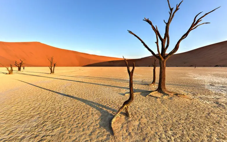
Coastal deserts form along the western margins of continents in subtropical latitudes, where cold ocean currents flowing along the coast chill the overlying air and cause moisture to condense as fog rather than falling as rain inland. The cold water stabilizes the atmosphere, suppressing the convective activity that produces rainfall, resulting in extremely dry conditions right at the ocean’s edge. The Atacama Desert of Chile and Peru, one of the world’s driest places, borders the Pacific Ocean and is chilled by the Humboldt Current — some weather stations in the Atacama have never recorded measurable rainfall in their entire history of operation. The Namib Desert of southern Africa, chilled by the cold Benguela Current, is another classic coastal desert, receiving less than 25 millimeters of rain per year in many areas while thick fogs roll in daily from the Atlantic Ocean.
Rain Shadow Deserts
Rain shadow deserts form on the leeward side of mountain ranges, where moist air rising over the mountains loses its moisture as precipitation on the windward slopes, then descends as dry, warm air on the opposite side. As the air rises, it cools and condenses, releasing rain and snow on the mountain slopes facing the prevailing winds. By the time it descends on the other side, it has lost most of its moisture and warms rapidly as it compresses, creating hot, dry conditions at the base of the mountains. The Patagonian Desert in Argentina, lying in the rain shadow of the Andes, is the largest desert in South America, covering approximately 673,000 square kilometers. The Great Basin Desert of the western United States sits in the rain shadow of the Sierra Nevada and Cascade ranges, receiving less than 300 millimeters of precipitation annually across much of its extent.
Subtropical Deserts
Subtropical deserts are hot deserts specifically driven by the global atmospheric circulation pattern that produces persistent high-pressure systems over subtropical latitudes. The Hadley Cell — a large-scale atmospheric convection loop — causes air to rise at the equator, travel poleward at high altitude, and descend at around 30 degrees latitude, creating zones of high pressure, clear skies, and low precipitation. Most of the world’s major hot deserts, including the Sahara, the Arabian Desert, the Sonoran Desert, and the Australian Desert, are subtropical deserts driven by this mechanism. Together, the world’s subtropical deserts account for the majority of the Earth’s total desert area, covering tens of millions of square kilometers across Africa, Asia, Australia, and the Americas.
Interior Continental Deserts
Interior continental deserts, also known as mid-latitude deserts, form deep within large continents far from any ocean moisture source. By the time air masses traveling inland have crossed hundreds or thousands of kilometers of land, they have lost most of their moisture through precipitation over coastal and upland areas, arriving at the continental interior as dry, moisture-depleted winds. The Gobi Desert and the Taklamakan Desert of Central Asia are prime examples — the Taklamakan, with an area of approximately 337,000 square kilometers, is one of the world’s largest sandy deserts and is so dry that its name is often translated as “you go in but you don’t come out.” Interior continental deserts experience extreme temperature ranges between summer and winter, and between day and night, because the absence of oceanic influence removes the moderating effect of water on temperature.
Monsoon Deserts
Monsoon deserts are arid regions that experience a highly seasonal climate, with a pronounced dry season of many months followed by a brief but intense rainy season driven by monsoon circulation. Unlike most deserts that receive uniformly low rainfall throughout the year, monsoon deserts receive the majority of their limited annual precipitation in a single wet season, with the rest of the year being completely dry. Parts of the Thar Desert in India and Pakistan fall into this category, receiving most of their 100 to 500 millimeters of annual rainfall during the summer monsoon months of July and August, then experiencing near-total drought for the remaining ten months of the year. The unpredictability and intensity of monsoon rains can cause dramatic but short-lived flooding across desert landscapes that are otherwise parched for most of the year.
Trade Wind Deserts
Trade wind deserts form in regions dominated by the persistent trade winds — the steady, easterly winds that blow from the subtropical high-pressure belts toward the equator. These winds are typically dry because they have descended from high altitude and warmed as they compressed, reducing their relative humidity and suppressing precipitation. The Sahara Desert is partly a trade wind desert, with the hot, dry Harmattan wind blowing southwestward across West Africa carrying sand and dust from the desert interior. The Arabian Desert and parts of the Australian Outback are also influenced by trade wind dynamics. Trade winds are responsible for some of the world’s most intense dust storms, capable of carrying Saharan dust across the Atlantic Ocean to fertilize the Amazon rainforest — a remarkable example of intercontinental environmental connection.
Rocky Deserts (Hamada)
Rocky deserts, known in Arabic as hamada, are arid landscapes dominated by bare rock surfaces from which sand and finer particles have been stripped away by wind erosion. Rather than the sweeping dunes of popular imagination, hamada landscapes present a stark, angular terrain of exposed bedrock, stone pavements, and rocky ridges sculpted by wind abrasion into dramatic forms. Approximately 70 percent of the Sahara Desert is rocky rather than sandy — the vast sand seas that characterize the popular image of the Sahara actually cover only about 25 percent of its total area. The Tibesti Massif and Ahaggar Mountains rising from the Saharan hamada are among the most remote and geologically spectacular landscapes on Earth, their ancient volcanic rocks carved into extraordinary shapes by millions of years of wind erosion.
Sandy Deserts (Erg)
Sandy deserts, known as ergs in Arabic, are the vast seas of sand dunes that most people associate with the word “desert.” They form where the conditions are right for sand to accumulate — where there is a sufficient supply of sand-sized particles, prevailing winds to transport them, and a topographic basin or obstacle to trap them. Despite their iconic status, true sand seas cover only about 20 to 25 percent of the world’s desert area. The Empty Quarter — Rub’ al Khali — of the Arabian Peninsula is the world’s largest continuous sand sea, covering approximately 650,000 square kilometers across Saudi Arabia, the UAE, Oman, and Yemen. The Algerian Sahara contains some of the world’s tallest sand dunes, with dunes in the Issaouane Erg reaching heights of over 300 meters.
Gravel Deserts (Reg or Serir)
Gravel deserts, known variously as reg in North Africa and serir in Libya and Egypt, are arid plains covered by a layer of coarse gravel, pebbles, and stones from which finer particles have been removed by wind deflation. The surface layer of gravel forms a natural armor — sometimes called desert pavement or gibber plain in Australia — that protects the underlying finer material from further wind erosion. Gravel deserts are among the flattest and most featureless landscapes on Earth, stretching for hundreds of kilometers with minimal topographic variation. They cover vast areas of North Africa and the Middle East, and the gibber plains of the Australian Outback — covering approximately 1.5 million square kilometers — represent the world’s most extensive gravel desert landscape. Despite their apparent barrenness, desert pavements are fragile surfaces that can take thousands of years to form and are easily disturbed by vehicle tracks.
Salt Deserts (Salt Flats)
Salt deserts, also known as salt flats or playas, form in enclosed basins where water periodically flows in but has no outlet to the sea, evaporating and leaving behind thick deposits of salt and other minerals. Over thousands of years, these cycles of flooding and evaporation build up layers of salt, gypsum, and other evaporite minerals that can reach depths of several meters. The Salar de Uyuni in Bolivia, the world’s largest salt flat, covers approximately 10,582 square kilometers at an elevation of 3,656 meters above sea level and contains an estimated 50 to 70 percent of the world’s known lithium reserves — a resource of enormous strategic importance in the age of electric vehicles. Death Valley’s salt flats in California and the Dasht-e Kavir salt desert of Iran are other notable examples of this striking and economically significant desert type.
Fog Deserts
Fog deserts are a specialized subset of coastal deserts where regular, dense fog provides a significant but non-rainfall source of atmospheric moisture, supporting specialized plant and animal communities that are uniquely adapted to harvest water from fog. The Namib Desert of southern Africa is the world’s premier fog desert, where the cold Benguela Current generates coastal fogs that roll inland for up to 100 kilometers on approximately 180 days per year, providing moisture that sustains a remarkable diversity of life including the extraordinary Welwitschia plant, some individuals of which are estimated to be over 2,000 years old. The Atacama Desert also experiences regular fog known locally as camanchaca. Fog-harvesting beetles, specialized grasses, and succulent plants of fog deserts have inspired engineers developing passive water collection systems for use in arid regions around the world.
Polar Ice Deserts
Polar ice deserts represent the extreme end of the desert spectrum — landscapes so cold that virtually all water is permanently locked in ice and snow, with liquid water essentially unavailable to living organisms for most or all of the year. The interior of Antarctica is the world’s coldest and driest desert, where temperatures can fall below -89°C — the lowest naturally occurring temperature ever recorded on Earth’s surface — and where annual precipitation equivalent is less than 50 millimeters across the polar plateau. Despite these extreme conditions, life persists in remarkable forms: microbial communities survive within the pores of translucent rocks, antifreeze proteins allow certain organisms to function at sub-zero temperatures, and the Dry Valleys of Antarctica — ice-free areas kept clear of snow by katabatic winds — host living communities of bacteria and algae that have adapted to one of the most hostile environments on the planet.